• BC Tourism FC
  • Tackling Tariffs
  • News
  • Value of Tourism
  • Our Commitments
  • Work With Us
  • Contact Us
Destination British Columbia logo
  • Who We Are
    • Overview
    • Provincial Government of BC
    • Board Of Directors
    • Executive Leadership
    • Tourism Marketing Committee
    • Accessibility and Inclusion Committee
    • Regional, Community & Industry
      Partners
      • Industry Partners
      • Community Partners
      • Indigenous Tourism
    • Vancouver, Coast & Mountains Tourism Region
      • Industry Support Areas
      • Meet the Team
      • Events
      • Regional Maps
      • Stay Connected
    • Corporate Documents
    • The Value of Tourism
  • What We Do
    • Overview
    • BC’s Destination Brand
      • Tools and Image Bank
    • Marketing
      • Consumer Marketing
      • Content Marketing
      • Social Media Marketing
      • Travel Trade
      • Travel Media
      • Our Markets
    • Destination Management
      • Destination Development
      • Planning Area Look Up Tool
      • Emergency Preparedness
      • Industry Development
      • Visitor Services
      • BC Tourism Climate Resiliency Initiative
    • Funding Sources
      • Co-op Marketing
      • Municipal & Regional District Tax Program (MRDT)
      • External Funding Sources
  • Strategic Approach
    • Overview
    • Corporate Strategy
      • Our 2023-2025 Corporate Strategy
      • Engagement and Input
      • Connecting Respectful Growth of Indigenous Tourism to Truth and Reconciliation
      • Where We Will Focus
      • How We Will Succeed: Our Strategic Levers
      • Summary of Key Strategic Shifts
      • Alignment to Government Strategies
    • Marketing Strategy
    • Invest in Iconics Strategy
      • Strategy Overview
      • Timelines and Engagement
      • Destination Development
      • Place Branding
      • Rainforest to Rockies
      • The Great Wilderness
      • Frequently Asked Questions
    • Diversity, Equity, Inclusion, and Accessibility
    • Truth and Reconciliation
  • Learning Centre
    • Overview
    • Experience Development
    • Digital Marketing
    • Social Media Marketing
    • Travel Trade & Travel Media
    • Applying Insights
    • BC's Destination Brand Resources
    • Accessible Tourism
    • Safety & Emergency Preparedness
  • Research & Insights
    • Overview
    • Industry Performance
    • Regional Research
    • Market Research
    • Activity Research
    • Resident Research
    • Research Tools & Methods
  • BC Tourism FC
  • Tackling Tariffs
  • News
  • Value of Tourism
  • Our Commitments
  • Work With Us
  • Contact Us

Destination Development

Southern Vancouver Island

  • Home
  • |
  • What We Do
  • |
  • Destination Management
  • |
  • Destination Development
  • What We Do
    • Overview
    • BC’s Destination Brand
      • Tools and Image Bank
    • Marketing
      • Consumer Marketing
      • Content Marketing
      • Social Media Marketing
      • Travel Trade
      • Travel Media
      • Our Markets
    • Destination Management
      • Destination Development
      • Planning Area Look Up Tool
      • Emergency Preparedness
      • Industry Development
      • Visitor Services
      • BC Tourism Climate Resiliency Initiative
        • BCTCRI: Project One
        • BCTCRI: Project Two
        • BCTCRI: Project Three
        • BCTCRI: Project Four
    • Funding Sources
      • Co-op Marketing
      • Municipal & Regional District Tax Program (MRDT)
      • External Funding Sources

Destination development is the strategic planning and advancement of defined areas to support the evolution of desirable destinations for travellers, with a focus on the supply side of tourism, by providing compelling experiences, quality infrastructure, and remarkable services to entice visitation.

Destination BC offers destination development planning assistance, in partnership with Indigenous Tourism BC, the Ministry of Tourism, Arts, Culture and Sport, and Regional Destination Marketing Organizations, to support the ongoing viability of BC’s tourism sector. Across the province, multiple 10-year destination development strategies have been created, along with regionally specific strategies. Provincially, the Invest in Iconics Strategy is a long-term strategy to responsibly grow tourism in more places in British Columbia at more times of the year.

Through destination development, we envision BC as a world-class tourism destination which offers remarkable products and experiences that are authentic, driven by visitor demand, and exceed expectations. By working together with a wide variety of partners, the strategies will guide the long-term growth of tourism experiences and revenues within the province.

Destination development in your area could include working with individuals and partners from the following organizations:

  • Tourism industry (CDMOs, tourism businesses, and associations)
  • Local and regional economic development agencies and economic development trusts
  • First Nation governments and Indigenous tourism organizations
  • Local and regional governments
  • Not-for-Profit organizations (heritage/arts/cultural organizations, community groups)
  • BC government ministries

Program Goals

Make British Columbia the most highly recommended destination in North America.
Create strategic plans for tourism development and improve return-on-investment for government and private sector investments in tourism assets.
Elevate British Columbia’s ability to compete as a premium destination while making the province more attractive for investment.
X

Destination Development throughout BC

Destination BC continues to work with communities across the six tourism regions on destination development strategies that pull together planning, policy, and capacity building efforts. Explore how each of the tourism regions are working together, and with various partners, to address impediments to tourism growth and strengthen relationships to capitalize on future tourism opportunities.

Regions

  • Cariboo Chilcotin Coast >
  • Kootenay Rockies >
  • Northern BC >
  • Thompson Okanagan >
  • Vancouver, Coast & Mountains >
  • Vancouver Island >
200 km 124 mi

Planning Area Look Up Tool


Use the tool below to look up which planning area and tourism region your location falls within. The search result will also give you a link to the relevant Destination Development strategy.


Use the selectors below to see which planning area and tourism region your location falls within.

This tool captures all First Nations communities, Municipalities, and Regional District Electoral Areas across British Columbia.

Search Results

Location:
Planning Area(s):
Tourism Region:

Links to the Destination Development strategies for the relevant planning area(s):

Columbia Valley

Full Strategy Highlights

The planning area lies between the Purcell Mountain Range to the west and the Canadian Rockies to the east, and includes Columbia Lake, Lake Windermere, the Columbia Wetlands, and the Columbia River as well as Kootenay National Park. Geographically, the Valley extends some 102 kilometers from the community of Spillimacheen in the north to Canal Flats in the south and includes areas of the Regional District of East Kootenay.

West Kootenay & Revelstoke

Full Strategy Highlights

The planning area stretches from Rossland, Trail, and Castlegar in the west to Revelstoke in the north and Creston in the east. The southern boundary is the US border. It includes the communities of Revelstoke, Nakusp, New Denver, Silverton, Slocan, Kaslo, Creston, Nelson, Salmo, Montrose, Fruitvale, Warfield, and all areas of the Regional District of Central Kootenay, and areas of the Regional District of Kootenay Boundary and parts of the Columbia Shuswap Regional District.

South Central Island

Full Strategy Highlights

The planning area includes the entirety of three regional districts, Alberni-Clayoquot, Nanaimo and Cowichan, as well as the Southern Gulf Islands, which form part of the Capital Regional District.

North Island

Full Strategy Highlights

The planning area encompasses 41,043 square kilometers of the Mount Waddington, Strathcona and Comox Valley Regional Districts. The main areas driving tourism are Strathcona Provincial Park, Comox, Campbell River, and Port Hardy.
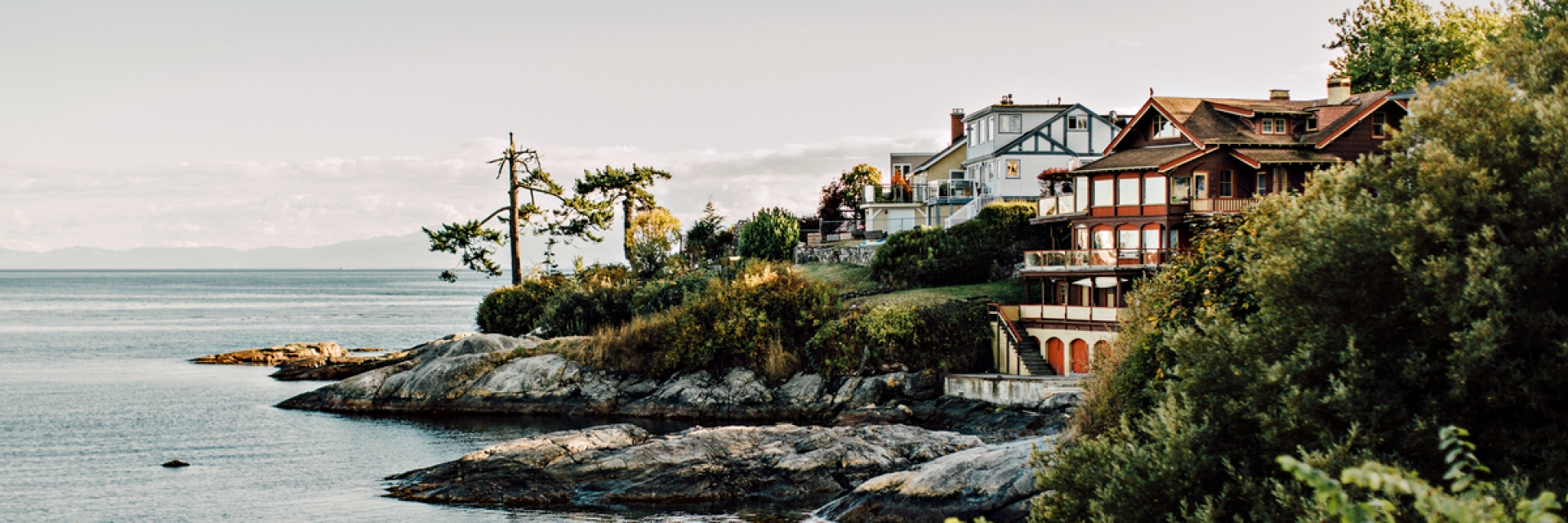
Greater Victoria

Full Strategy

The planning area encompasses all of the Capital Regional District (CRD) which includes the Saanich Peninsula in the east, to the Malahat in the north and on to Port Renfrew in the west and does not include the Gulf Islands.

Sunshine Coast

Full Strategy Highlights

The planning area stretches from northwest of Langdale along 180km of land to north of Lund to Bliss Landing, Desolation Sound and waterways to the northern tip of Toba Inlet. It encompasses the jurisdictions of the Sunshine Coast Regional District, the Powell River Regional District and includes the following islands: Gambier, Keats, Nelson, Hardy, Thormanby, Texada, Lasqueti, Harwood, and Savary.

Fraser Valley

Full Strategy Highlights

The planning area includes Langley and Pitt Meadows to the west, Hope and Manning Park to the east, the US border to the south, the tops of Golden Ears Provincial Park and Harrison Lake to the north, and all parts in between. It also includes the Fraser Valley Regional District and parts of Metro Vancouver.
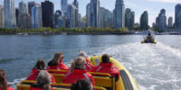
Metro Vancouver

Full Strategy Highlights

The planning area includes Langley and Maple Ridge to the east, Vancouver to the west, Delta and Surrey (and the US border) to the south, the North Shore and Lions Bay to the north, and all parts in between. Communities in Metro Vancouver coincide with those within the Metro Vancouver Regional District.

Highway 3 Corridor

Full Strategy Highlights

This planning area (including Highway 3A, 3B, and 43) stretches east to west from Hope along 838 km of mountainous roads to the Alberta border. The Highway 3 Corridor has concluded their Destination Development Strategy and are working towards implementation.

Highway 1 Corridor

Full Strategy Highlights

The planning area stretches from the Alberta border in the east to Kamloops/Savona in the west and includes Yoho National Park, Glacier National Park, and Revelstoke National Park. This portion of the Trans-Canada Highway extends some 550 kilometers and includes the Village of Field, the Town of Golden, the City of Revelstoke, the District of Sicamous, the City of Salmon Arm, the Village of Chase, the City of Kamloops, and Sun Peaks Mountain Resort Municipality.

Shuswap-North Okanagan

Full Strategy Highlights

The planning area encompasses the Regional District of North Okanagan, areas of the Columbia Shuswap Regional District and, the Village of Chase in the Thompson Nicola Regional District. The key communities include Salmon Arm, Sicamous and Chase along Highway 1; Falkland on Highway 97, and Enderby, Armstrong, Vernon, Coldstream and Lumby in the North Okanagan.

Okanagan Valley

Full Strategy Highlights

The planning area encompasses the Regional District of Central Okanagan, Similkameen Regional District, and the Regional District of Kootenay Boundary. Municipalities include Lake Country, Kelowna, West Kelowna, Peachland, Summerland, Penticton, Oliver, Keremeos, and Osoyoos.

North Thompson & Nicola Valleys

Full Strategy Highlights

The planning area encompasses a portion of the Regional District of Fraser-Fort George and from Porcupine Meadows Park southwest to Savona, and the remainder south of the area, just south of Kamloops, along 5A until Sun Peaks in the east, with communities along Highway 1 of the Thompson-Nicola Regional District (TNRD). Municipalities include McBride, Valemount, Clearwater, Barriere, Sun Peaks, Kamloops, Logan Lake and Merritt.

Northwestern BC

Full Strategy Highlights

The planning area spans from Tatshenshini-Alsek Park at the Alaska-Yukon-BC border south to the start of Highway 37 and west from Prince Rupert to the area east of Valemount.

Northeastern BC

Full Strategy Highlights

The planning area spans from the northern tip of the BC portion of the Alaska Highway (Highway 97) to the Yukon-BC border, south to Prince George and from the western edge of the Muskwa Kechika Management area and east to the Alberta border.

Haida Gwaii

The planning area is located approximately 130 km off the BC coast and 640 km north of Vancouver and is accessible by air and sea. The closest mainland transportation access is from Prince Rupert via BC Ferries. Haida Gwaii encompasses over 200 islands, totaling 3750 square miles, or 1,000,000 hectares with two developed islands.

No strategy has been developed yet. Please get in touch with Northern BC Tourism staff for further information.

Sea-to-Sky Corridor

Full Strategy Highlights

The planning area encompasses all of the North Shore of Metro Vancouver Regional District and the Squamish-Lillooet Regional District. This estimated 260-kilometre-long area includes North Vancouver, and Burrard Inlet through West Vancouver to Horseshoe Bay, and then north where the route meets the Howe Sound coastline to Squamish. There the route continues inland through the Coast Mountain Range. The Sea-to-Sky Corridor includes all communities and remote areas in between North Vancouver and Lillooet, including Bowen Island and the Bridge River Valley, north of Pemberton.

Interlakes

Full Strategy Highlights

The planning area, which encompasses the main corridor of Highway 24, and its junction with Highways 97 and 5, stretches across the Bonaparte Plateau to the North Thompson Valley, including Wells Gray Provincial Park and the communities of Barriere and Clearwater. The western side of the area is bounded by a portion of Highway 97 to include the area between 70 Mile House and 100 Mile House. To the south the area includes Bonaparte Lake. To the north, the boundary is Canim-Hendrix Rd, Canim Lake, Crooked Lake, Azure Lake and the northern boundary of Wells Gray Provincial Park.

Gold Rush Trail

Full Strategy Highlights

The planning area is a 750km corridor from New Westminster to Stone Creek and Barkerville, following the Fraser Canyon and Fraser River that follows traditional Indigenous trading routes utilized during the fur trade and expanded through the gold rushes of 1858-1862.

Chilcotin Central Coast

Full Strategy Highlights

The planning area which encompasses the area west of the Fraser River stretching across the Chilcotin Plateau to the central coast, north to include Hartley Bay, Entiako, Finger-Tatuk and Fraser River Provincial Park, and south to include Bute Inlet, the Homathko Icefield and Big Creek Provincial Park.

If you are you looking for more information, or have any questions, please reach out to the Destination Development representative for the Vancouver Island region Vancouver, Coast & Mountains region Thompson Okanagan region Northern BC region Kootenay Rockies region Cariboo Chilcotin Coast region

destination development case studies

The following collection of 12 case studies showcases the social, cultural, and economic advantages of tourism through destination development initiatives, highlighting their positive impact for both visitors and residents. These compelling stories engage communities and local partners interested in destination development and its many benefits for communities across BC. Featuring two projects from each of the six tourism regions in BC, the series illustrates community destination development through collaborative regional and local partnerships. These stories inspire and offer valuable insights and learnings that can be adapted to support future tourism endeavours in other areas or communities. This case study series was created by Destination BC through collaboration with the Ministry of Tourism, Arts, Culture and Sport and the six Regional Destination Management Organizations in BC.

Morfee Mountain Ridgeline Trail

When developing the Morfee Mountain Ridgeline Trail, the Mackenzie Outdoor Route & Trail Association initially sought small grants to build momentum and attract further funding, resulting in the opening of a 15-kilometre alpine trail in summer 2023, designed for both novice and experienced riders and also accessible to hikers.
Read

Mt. Abriel Trail Network

In the Kootenay Rockies, the Nakusp Bike Society, funded by the Community Economic Recovery Infrastructure Program from the Ministry of Tourism, Arts, Culture and Sport, developed accessible mountain bike trails to the top of Mt. Abriel Trail and improved the network’s parking lot, picnic shelter, and camping areas to open the area to a wider audience.
Read

Nemiah Valley Lodge

Nemiah Valley Lodge—owned by the Xeni Gwet’in Peoples—practices sustainable tourism and celebrates Indigenous heritage, having undergone years of renovation, rebranding, and strategic development to create authentic cultural experiences that respect environmental values and appeal to a diverse global audience.
Read

Tumbler Ridge Global Geopark

The Tumbler Ridge Global Geopark offers year-round activities such as hiking, snowmobiling, and exploring the Dinosaur Discovery Gallery, recently expanding with mountain bike trails and the region's only pump track to boost year-round visitation, support economic development, and increase local employment.
Read

Accelerate Kootenays

In the Kootenay Rockies, a multisector collaboration increased the number of charging stations in the area, helping to power tourism with electric vehicle charging stations and supporting sustainable transportation, reducing emissions, and creating economic growth in the region.
Read

BC’s Fishing Highway

Several tour operators formed the volunteer-run Fishing Highway Tourist Association to promote the route and enhance visitor experiences by adding lake signage, repairing docks and boat launches, refurbishing campgrounds, and installing washrooms, aiming to encourage exploration of all sections of the highway.
Read

Cross-Country Ski Trails in the Thompson Okanagan

The Larch Hills Nordic Society and Overlander Ski Club received funding from the Targeted Regional Tourism Development Initiative to improve trails and add lighting, aiming to expand visitor demographics, attract more night-time cross-country skiers, and boost the local economy.
Read

Don’t Love It To Death

The Sea-to-Sky Corridor Destination Development Strategy includes the "Don't Love It To Death" initiative, developed from community and Indigenous feedback to promote respectful land use and responsible outdoor conduct through bold storytelling that inspires social change.
Read

Expanding Mountain Bike Infrastructure in the Thompson Okanagan

In 2022-23, the non-profit associations of three Thompson Okanagan resorts received provincial funding to develop accessible mountain bike infrastructure, successfully attracting more mountain bikers of all abilities, facilitating crossover tourism between resorts, and boosting the local economy.
Read

Experience the Fraser

Experience the Fraser is a multi-partner initiative to develop walking, cycling, and boating routes along the Lower Fraser River Corridor, aiming to strengthen tourism and economic development, enhance understanding of Indigenous connections to the river, and encourage entrepreneurial tourism opportunities from Hope to the Salish Sea.
Read

First Impressions Assessment

Inspired by the US First Impressions Community Exchange, 4TVI developed the First Impressions Assessment as a destination development tool to help remote and rural communities on Vancouver Island evaluate their strengths and challenges, addressing issues like demographic changes, aging infrastructure, and limited resources to improve tourism offerings.
Read

Indigenous Voices of Vancouver Island

On Vancouver Island, the podcast "Indigenous Voices of Vancouver Island," created by 4TVI and hosted by Tchadas Leo of the Homalco First Nation, was created to boost mindful travel by sharing compelling stories and perspectives from Indigenous Peoples.
Read

Morfee Mountain Ridgeline Trail

When developing the Morfee Mountain Ridgeline Trail, the Mackenzie Outdoor Route & Trail Association initially sought small grants to build momentum and attract further funding, resulting in the opening of a 15-kilometre alpine trail in summer 2023, designed for both novice and experienced riders and also accessible to hikers.
Read

Mt. Abriel Trail Network

In the Kootenay Rockies, the Nakusp Bike Society, funded by the Community Economic Recovery Infrastructure Program from the Ministry of Tourism, Arts, Culture and Sport, developed accessible mountain bike trails to the top of Mt. Abriel Trail and improved the network’s parking lot, picnic shelter, and camping areas to open the area to a wider audience.
Read

Nemiah Valley Lodge

Nemiah Valley Lodge—owned by the Xeni Gwet’in Peoples—practices sustainable tourism and celebrates Indigenous heritage, having undergone years of renovation, rebranding, and strategic development to create authentic cultural experiences that respect environmental values and appeal to a diverse global audience.
Read

Tumbler Ridge Global Geopark

The Tumbler Ridge Global Geopark offers year-round activities such as hiking, snowmobiling, and exploring the Dinosaur Discovery Gallery, recently expanding with mountain bike trails and the region's only pump track to boost year-round visitation, support economic development, and increase local employment.
Read

Get in Touch

To find out more about the Destination Development program or to determine the best way for you to participate, contact us at DestinationDevelopment@DestinationBC.ca

Subscribe to Directions, Destination BC’s e-newsletter, for the latest news and program updates.

Receive updates, research and news you can use.

Destination BC

  • Work With Us
  • Contact Us
  • News
  • Corporate Documents
  • Site Map
  • Legal Terms & Privacy Policy

Official Websites

Spirit Bear

HelloBC.com

Be inspired to start planning your BC Vacation.

B.C. and Guangdong work together to open doors for businesses, create good jobs in B.C.

Travel Media

Information for journalists, editors and broadcasters.

Travel Trade

Tools, resources and contacts to assist you in promoting BC.

red truck in a vineyard

Tourism Business Portal

Online, self-service business listings system for tourism industry.


Follow Us:

Twitter Youtube Linkedin

Subscribe to our newsletter

Subscribe
Destination British Columbia logo
© 2025 - Destination BC Corp. – All rights reserved. "Super, Natural British Columbia®", "Super, Natural", "Hello BC" and "Visitor
Centre" and all associated logos/trade-marks are trade-marks or Official Marks of Destination BC Corp.